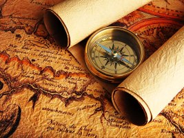
Man has been researching the directions, determining and identification of paths and researching construction of the earth since man has started traveling. It can’t be denied that man is busy in devising better navigation system since beginning. The study of the earth, its construction, structure and study of its inhabitants is called geography while mapping of the earth is called cartography. With the passage of time many units and tools were framed for geography and cartography. Modern cartography is, to great extent, conjoined with geography; cartography provides the basics of many geographical matters. Modern man has found primitive maps which proves that cartography is an ancient branch of knowledge.
Eratosthenes (276-194 B.C) a Greek mathematician and geographer did first research about the earth. He devised some rules about mapping and gave information with the help of different methods about measurement of the earth. These rules are still being used in modern times. Definitely this process was being continued by the others. Then the Abbasid caliph Haroon Ul Raheed’s son Mamoon Ul Rasheed got preceded the job of cartography. But in 1017, a brilliant Muslim scientist Al-Biruni did more exact measurement than his predecessors. His assumed radius of the earth was 6335 Km. Modern research has proved that he was right with the difference of 36 km.
First compass for the direction was invented in China between the 2nd century B.C. and 1st century A.D. Western Europe started using the compass between 1187 and 1202, and in Persia in 1232.
The man used to determine directions and paths with the help of stars in the past but now he has a latest and modern geographical navigation system. Every place is marked on the earth now with the help of longitude and latitude. In modern system, satellites are being used to identify places. The most famous satellite system is GPS (Global Positioning System) with the help of which we can get information about any specific place, its altitude to sea level, the speed and direction during traveling. By combining information got from GPS with mapping, there is a complete system having directions and mapping information. In 1973 American defense department made GPS system but it properly worked in 1995 and it is being refined day by day. Europe Union, China, Russia and India are also trying to make their own such GPS system.
Many other companies besides NASA are now providing free information about geography and mapping, the most famous is Google. Google has made two programs (Google Earth and Google Maps) for a common man. The foundation of Google Earth was not laid by the Google; it was first laid by a company “Keyhole” funded by CIA and the initial name was Earth Viewer. In October 2004 Google purchased Keyhole company along with another mapping company. Afterwards in February 2005 Google started Map service. In June 2005 Google made some amendments in the software Earth Viewer and launched a new software Google Earth.

